Hike Report Archive

Thursday, June 7, 2012

Hike Report: Dufferin Hi-Land 5 – Prince of Wales Road at Kilgorie Side Trail to 30th Sideroad/1st Line EHS

Section: Dufferin Hi-Land  5 – Prince of Wales Road  at Kilgorie Side Trail to 30th Sideroad/1st Line EHS Marker 36.9 km to 52.9 km

Hike Leader: John N

 Hikers: John G, , Bill, Anita and John N


 This was a south to north hike along the white trail. The weather was quite warm and sunny. The forecasted rain did not materialize during the entire hike. After walking along a short road section north of the Kilgorie Side Trail we entered a mixed forest area climbing to a lookout. We then descended back down to Prince of Wales Road.


 We continued up a steep climb passing through a mature hardwood forest then continued uphill to an open ridge where we had spectacular views over a valley and some of the richest farmland in Ontario. We were going over numerous stiles during this period. At this point we had a deer encounter and watched as it bounded off after seeing us. We passed by a farm that had two silos. 


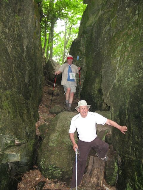
  After that we entered a bush area and went through a rocky section for the first and only time during the day before crossing a picturesque bridge.  There was another steep climb down then up again, (this was proving to be a hilly hike!) After reaching another high point we had a wonderful view to the east across the Nottawasaga Lowlands to the hills of Essa Township. At County Road 21 we stopped and had a pleasant chat with a member of the Dufferin Hi-Land Bruce Trail Club.


  It was time for a lunch stop which we had overlooking a hay field to a pine plantation. Thereafter we had a relatively easy walk along a road allowance to our stopping point. Pete’s Donuts beckoned. This was a rather hot, sticky, hilly hike but the views, farmlands and wooded areas made it all very gratifying.


Thursday, May 31, 2012

Hike Report :Blue Mountain 5. Including Mission Road and Swiss Meadows Side trails

Section: Blue Mountain 5. Including Mission Road and Swiss Meadows Side trails.. Km 58.2 to 66  -

 Blue Mountains Club completed!!

 Hike Leader: John Nourse

 Hikers: John G, Anita and John N,

  
After meeting at Pete’s  we proceeded to leave a car at the end of Blue Mountains and drove back to hwy 19 where we met up with a local group hiking the other way.


  We started along a long road allowance past Castle Glen estates. At the 12th side road we joined the Mission road side trail. 


This took us through to the scenic caves road where we preceded up past the cable bridge in the scenic caves grounds. 


After a short detour (the ski hill folks had a gravel pile covering the trail) we found our way along the top of the Blue Mountains skill hill and past the first chair lift.


 We stopped for a short break and then proceeded along the interesting trail at the top of the ski hill.
As we moved along the top of the escarpment we encountered some very trampled and flat rock trail. Suddenly a load of trail bikers zoomed after us. They stopped and incorrectly pointed us toward the road. 

We guessed that it was wrong, backtracked a little then went down the escarpment 

through the bush finishing back to where the Swiss Meadows side trail started . 


This trail circled to the end where we celebrated with a well-deserved lunch.
 Back to Pete’s on the way home after a brilliant day and fun hike.


Saturday, May 26, 2012

Hike Report : Beaver Valley 3 including both Ken Young & Mac Kirk side trails

Section: Beaver Valley 3 including both Ken Young & Mac Kirk side trails. Marker 34.7 to 54.1km

Hike Leader for Blue & White Team  - John N

Hike Leader for Classic end-to-end - Rudi

Hikers: John G, Eldon and John N, ------ along with
Classic Hikers: Stephen, Rudi, Margaret, John Nich, Carol, Jaonne

We left from North street in Eugenia Joanne was still hurting from the damage done by her pedicurist had to stop after about 1 ½ km.

We helped her back to her car to await our return.


 We passed a new side trail not found on our maps nor the Bruce trail web site it was Graham hill & Campbell road side trail. The first major land mark was the surge towers at the power plant. It was a hot day and we passed through an open field before descending.

 We crossed on to hwy 13 and passed the cross valley side trail proceeding up to 4th line –A . We proceeded up old Baldy and had lunch just before entering Mac Kirk side trail,


we easily met the classic group at the other end and once again proceeded together. We again branched at the Ken Young side trail and waited for the Classic group at the end. We came out at the end of North Street which we had completed the road walking the previous day to get a head start on the  Saturday hike.


The end of the hike was Stephen’s Classic End-to-end at last completed. With an arch of poles Stephen was a happy man.  We proceeded back to the start point to meet Joanne and share the celebratory champagne.


Friday, May 25, 2012

Hike Report : Beaver Valley 2 including both Matcalf Crevice side trail and Chuck Grant side trail

Section: Beaver Valley 2 Marker 19.1 to 34.7 +
also included were Matcalf Crevice side trail and Chuck Grant side trail

Hike Leader for the Blue & White Team - John N

Hike Leader for the Classic end-to-end team - Rudi

 Hikers: John N, John G, Eldon along with 

Classic Hikers, Jen, Roy, Carol, John Nich, Rudi  Margaret, Diane, Bill and Stephen


 We Met Bill and the one day hikers at 9:00 am. Our whole group hiked along the white trail until John G, John N and Eldon Broke off to a blue side trail the Chuck Grant Side Trail.  The Trail was a mix of terrain. 


It was cooling to walk in the shade along the creek. Leaving a note at the junction of the trail we walked a short distance to Metcalk  rock. 


We met rock climbers and saw a unique braided tree in the Metcalf Rock Crevice side trail.  After a  water break and a snack we walked back to the white trail.  While stopped for lunch the rest of the hikers caught up wo us.  After lunch we all hiked out together to the cars where we compared blisters.  Some of the hikers  did the next part of the hiking on the road to lessen the distance for Saturday. Glad to be finished, “ no Pain no Gain” arriving back at the condo it was a “Cool ” beverage and a sho


Thursday, May 17, 2012

Hike Report: Blue Mountains 4a Pretty River Access Trail, Pretty River Side Trail, John Haigh Side Trail, Petun Side Trail, Russ McConnell Side Trail AND an unmarked bicycle trail

Section :Blue Mountains 4a – 46.1 to 57.5 including Pretty River Access Trail, Pretty River Side Trail, John Haigh Side Trail, Petun Side Trail, Russ McConnell Side Trail AND an unmarked bicycle trail recommended by a friendly cyclist – total 15.7 km of which 13.7 km was planned (loop hike)

Hike Leader : John N

Hikers: John N, Joanne, Ann, Anita, Tom and “Oprah”


Five hikers congregated at Pete’s Donuts (Hwy 10 and 89) for coffee departing shortly after 8 AM for the Pretty River valley roadside parking at which point, both cars were abandoned as we donned our hiking gear.  The weather was cool and sunny, starting at 6 deg.C and a predicted high of 13, and the trail was mostly dry with good traction underfoot.  We struck off uphill at 9:15 am and proceeded to climb uphill for about 3 km to the highest point on the Bruce Trail at 540 Meters above sea level.


   This section was quite strenuous, with one brief downhill stretch towards one of three ponds marked on the trail guide, and covered the Pretty river access and side trails, and the start of the John Haigh Side trail, as well as connecting parts of the main trail.  A brief stop with pictures and liquids permitted us to continue, having completed this section in one hour.  The trees were largely in full leaf, providing shade and sun protection, however limiting the views from vantage points overlooking Georgian Bay. The section following the ‘highest point’ was mostly flat until we reached the 2nd line near the end of the John Haigh Side Trail/start of the Petun Side trail. At two parking points we met several trail hikers, as Oprah made acquaintances with three other trail companions.


The 2nd line marked the start of the descent down from the escarpment with several views of Georgian Bay exhibiting various shades of blue off into the distance.  Very clear views to the east shore of Georgian Bay made it difficult to distinguish between the water, shoreline and sky on the horizon.  
 

 The gradual downhill became at times steep, with roadside running water from springs.  The Petun Side trail met the main trail again at Grey Road 19, the lowest point since leaving the cars (approximately 390 Meters ASL). Then, guess what! In true Bruce Trail fashion, what goes down must come back up; so we started our second major ascent continuing on the Petun Side trail to the top of Osler Bluff (and the private ski club by the same name). As you may be well aware, when on uphill, John has a Mission with head down ...and Oprah and he made the summit well ahead of the remainder of the crew. 


Once reaching the 490 Meter ASL contour, the trail again leveled out in mature forest, with many examples of ferns.  Two in particular were pointed out ... the Hart’s Tongue fern exhibiting long, wide ‘tongue like’ leaves in a cluster, and the Christmas fern, an evergreen of dark green colour (similar to the Northern Holly fern but with distinctive leaf shape).
  A vantage point with view over Georgian Bay (and a cool breeze) provided an opportunity for more pictures and a break for lunch.  


A few of us collected some wild leek leaves to add to our sandwiches, and subsequently, we managed to slow John down to allow him to collect additional leaves to add to salad on the home front. 
On the main trail again, we met a friendly cyclist (who also did hiking in the area), and he recommended a ‘cycling’ side trail as an alternative route back to our cars.  Not taking much stock in the suggestion at the time, we continued, expecting our travers of the Russ McConnell Side trail might bypass the cycle route. 


 Exiting the largely flat side trail, back onto the main trail, we again met the cyclist at the junction of the recommended cycle trail.  A study of the trail guide, and with the clue “to ‘proceed downhill’ and ‘in a southerly’ direction and you can’t get lost”, we expected there to be minimal added distance, and different ‘views’ with this exploratory route.  OOPS ... this trail did have a spectacular descent from the 490 M contour, but unexpectedly, the trail started northwards quite a distance ...adding 2 km to the planned hike. 


This trail did pass through a section of fallen birch trees and a couple of groves of Hemlock as advertised. But, we did persevere, stayed together, and found after circling all three ponds, made it back onto the Pretty River side trail, before reaching the main trail again and back to the cars at 3:15pm.  Hats off to the team for persevering, and completing effectively 16 km of some of the largest ascent/descent sections of Bruce Trail. Lessons have been learned by Tom and John ... but Oprah loved it, 


and celebrated by finding the blackest, dirtiest mud pond in which to cool off, just prior to arriving at the cars. 
Restorative sweets and coffee were awaiting us at Pete’s, after Tom detoured (followed his nose again) and toured the Pretty River Provincial Park, and the town of Rob Roy in transit.